31 March 2023
Coed Olaf - History of the Holloways and Paths
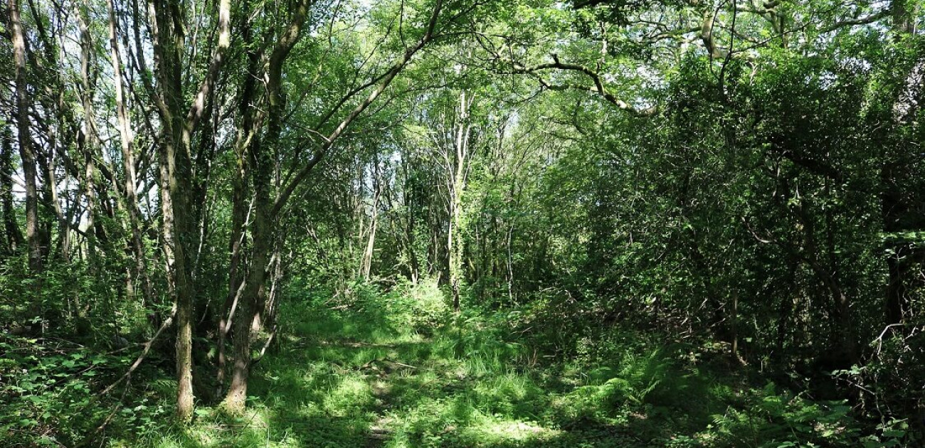
Continuing our review of the social history of Coed Olaf, we discuss the tracks that cross the woodland. In particular, there is a beautiful old holloway with two stone-faced banks and trees arching over it like the path in Lord of the Rings.
Before the railways and cars opened the fells up, folk walked. The landscape was crisscrossed with pathways that mostly went uphill from steppingstones that crossed the rivers and becks with fewer paths going along the valley. Paths followed the contours of the landscape, wending and winding their ways up and down the fells, coming up from the river, or from the farmhouses to their farmland. There are no paths on Cwm Garnant, perhaps because these were erased during inclosure, but there are traces of footpaths on Ty-isaf.
There were two ‘main’ roads that went from Garnant and Gwaun-Cae-Gurwen over the farmland and into the Betws hills. The first is Bryncethin Road which is now a road. The second is the holloway, which is now a public footpath. These may be of ancient origin: Bryncethin Road has a species-rich hedgerow that runs along the western edge of the wood; the public footpath has been bounded by two cloddiau.

The patient hard work that was needed to build the banks and clear the stones from the fields to face the earthen banks gives us pause for thought. Like the deep drainage ditches, these may be commonplace pieces of civil engineering but the more I find these stretches I am in awe of folk’s labour, hard work and patience in making them.

The holloway began east of Ty-isaf at the weir on the Garnant, then passed south of the farmhouse and went west to where the public footpath is today. Whereas its eastern end was removed when the railway was built, a short section still runs for 100 m in a hollow halfway up the hill, before disappearing where the public footpath carries on as a track through the wet meadow, Waungroes.
In the 1840s, the holloway was slightly to the south of the current path in Waunfach, below its southern boundary; it was rediscovered in 2022 and, while broken in places, parts of its northern clawdd can still be found on the edges of Cae Newydd and Cae Newydd Uchaf. The holloway with both cloddiau can be found just west of the entrance to Cae Newydd Uchaf, but these were clearly abandoned as too wet and the footpath moved several yards to the north.
In the nineteenth century, the holloway turned into a track that connected Ty-isaf to its partner farm, Blaen-y-garnant. Physical remains of this can be found in the wood in Coed Cae, as well as on older maps, where the path clearly turns south into Cae Canol, but no evidence has yet been found of a footpath linking the holloway to the path in Cae Canol.

At the northern end of Cae Bietin, there is a footpath in the hillside in a dip. This splits into two and both branches went down the hill into a field that had been assarted from the wood in the valley, then at least one of the paths would have continued down the hill to the Garnant, where it would have crossed the stream. However, the sections to the river and the assarted field were removed when the railway cut was excavated.
There was, also, a footpath that began at a crossing over the Garnant north of Ty-isaf. It went west up the hillside by the beck, before crossing the tip of Cae Carkit and west over Waunfach, then probably joined the holloway in the fields near Bryncethen Cottage, to the west of the woodland. So far, no physical evidence has been found of these tracks.
With the Industrial Revolution, most of these footpaths stopped being used and were replaced by the railway, the tramway, and roads as people’s means of transport.
Today, a new track wends its way from Bryncethin Road to the public footpath following the natural shape of the land. These are farm tracks to give access for tractors and go across the land whereas the footpaths went up and down the hillside. It was perhaps created after the Hamer’s bought the farmland, as they would only have had access onto their land via a gate on the main road. We have kept it as it was on acquisition, except for a slight tweak in Waunygarnant where we have moved it slightly to the west and so it now cuts through the willow carr.